Quebec: a vast territory, several terroirs
Quebec has well-defined wine regions. The identity of each of them is determined by geological, climatic and pedological specificities, and makes it possible to highlight the particularities of the terroirs of the Belle Province.
“Each terroir has its own history, intimately linked to its place and to the people who magnify its potential.” – Nadia Fournier, author and wine columnist.
Discover the wine regions of Quebec!
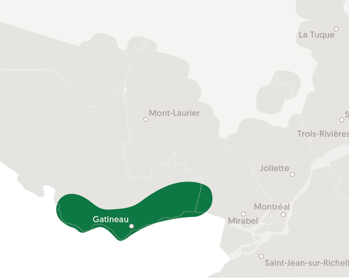
VALLÉES DES OUTAOUAIS
This region encompasses Deux-Montagnes, Mirabel and Vaudreuil-Soulanges, as well as some of the western parts of Montreal and Laval.
Geology and soils
To the east, between Papineauville and Montebello, the Outaouais plain is barely a kilometer wide, while to the west, it is nearly 10 km wide and is spread over two levels, separated by a clay escarpment that formed the former shore of the Ottawa River.
The lowlands along the Ottawa River are composed of thick layers of clay, marine deposits formed in postglacial seas. On the outskirts of the formerly submerged territories, there are soils of sand, gravel and pebbles, often associated with the beaches of these same seas.
Climate
The climate of this region, humid continental, is characterized by cold winters and hot summers. Rainfall is abundant year round. Warm winds come from the Great Lakes to the south; cold north or east winds.
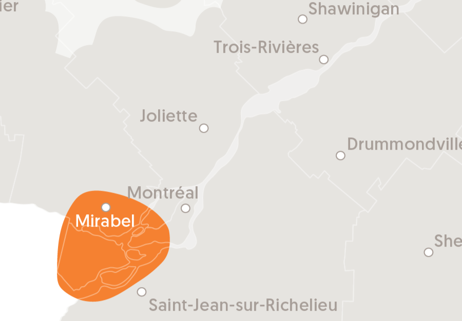
DEUX-MONTAGNES
This region encompasses Deux-Montagnes, Mirabel and Vaudreuil-Soulanges, as well as some of the western parts of Montreal and Laval.
Geology and soils
Its landscape is mostly flat, except for the Oka and Rigaud mountains, which give the region its name. The few narrow bands of glacial deposits create gentle hills that are covered in layers of marine sediments—ideal for growing strong, healthy grapevines.
Climate
This region benefits from the moderating effects of the surrounding bodies of water (Deux-Montagnes Lake, Lake Saint-Louis, Ottawa River and St. Lawrence River), which help regulate daytime and nighttime temperature variations. This region often experiences more snowfall in the winter than other regions located to the south of Montreal, providing an extra layer of insulation to the vines.
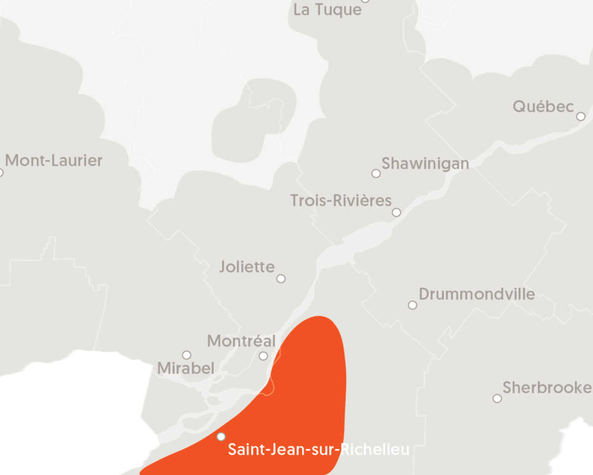
RICHELIEU RIVER VALLEY
This region stretches along the rolling hills of Montreal and extends from the St. Lawrence River to the east of the Richelieu River (the area between Iberville and Sabrevois). It also includes the hilly plains of the St. Lawrence high terraces that overlook the Adirondack foothills (Covey Hill area).
Geology and soils
The Richelieu River Valley is rich in clay and organic soils. This region is also largely made up of various glacial deposits, with a few small areas of gravelly, stony soil—perfect for growing grapevines.
Climate
Weather conditions in this region are among the best in the province for growing grapes, boasting the longest frost-free period, even though temperatures vary dramatically between winter and summer.
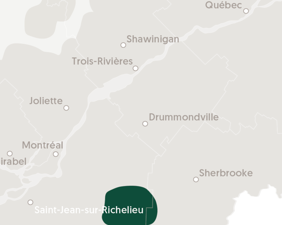
SOUTH APPALACHIAN FOOTHILLS
This region stretches from Lake Champlain to theSutton Mountains. It encompasses the Dunham area, also known as the birthplace of Quebec’s wine-growing industry. Its vineyards are found in two different soil regions—the St. Lawrence high terraces that overlook the Appalachian foothills to the west and the Appalachian Mountains to the east.
Geology and soils
The majority of the soils in this region developed from glacial sediments.
Climate
This region stands out for its diverse climate. The weather is generally better in the west, but cooler and not as mild in higher altitude areas like Frelighsburg and Sutton. The Saint-Armand vineyards are at a lower altitude and benefit from the tempering effect of Lake Champlain.
NORTHERN APPALACHIAN PIEDMONT
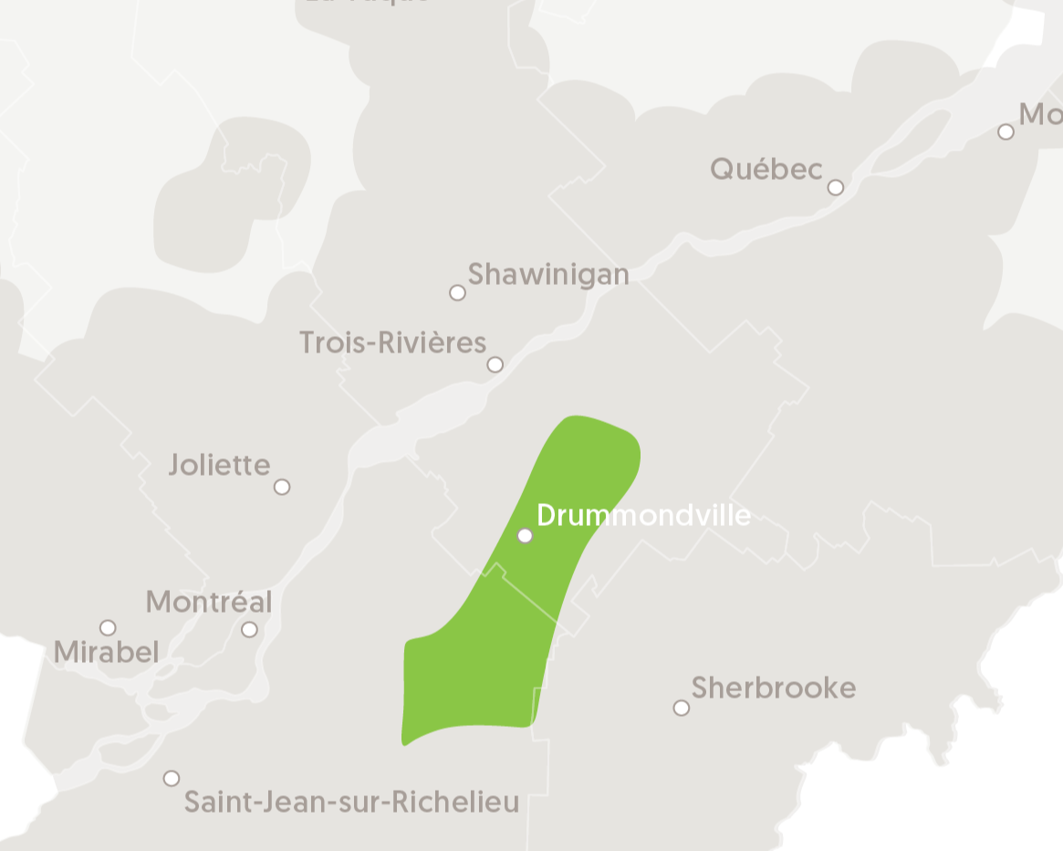
This region runs along the first reliefs of the Appalachians at an altitude varying from 50 to 300 meters. A few tens of kilometers wide on the outskirts of Mount Shefford, it narrows until it reaches only a few kilometers near Drummondville to the north.
Geology and soils
The soils and landforms of northern Appalachian Piedmont are very similar to those of the south. Resulting mainly from glacial deposits, the soils go from rather neutral and sometimes calcareous in the west to rather acid and gravelly (slate), further east.
Climate
It is in terms of climate that the region differs the most from its southern neighbour. The thermal amplitudes, between day and night temperatures will be greater as one goes north and east. The snow cover in winter will also be greater than in the southern part of the Appalachian Piedmont, and the growing season will be slightly shorter.
MONTEREGIAN HILLS
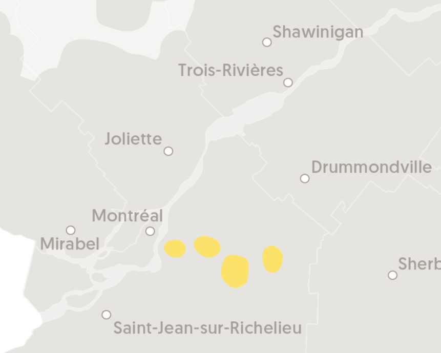
The vineyards in this region stretch all the way from the St. Lawrence River to the Appalachian Mountains, skirting along the edges of the Saint-Bruno, Saint-Hilaire, Rougemont, Saint-Grégoire and Yamaska mountains.
Geology and soils
This region is characterized by the Monteregian Hills, a group of 10 hills formed between 90 and 125 million years ago. The area surrounding the Monteregian Hills is covered with sand and gravel deposits, left behind by the beaches of the ancient Champlain Sea, and is where most of the vineyards in the region are located.
Climate
The vineyards in this region enjoy some of the best climatic conditions for growing grapevines. Planted on hillsides, the vines are exposed to varying amounts of sunshine—from the east, south or west—which strongly influences their microclimate. Temperatures vary dramatically between winter and summer.
APPALACHIAN PLATEAU
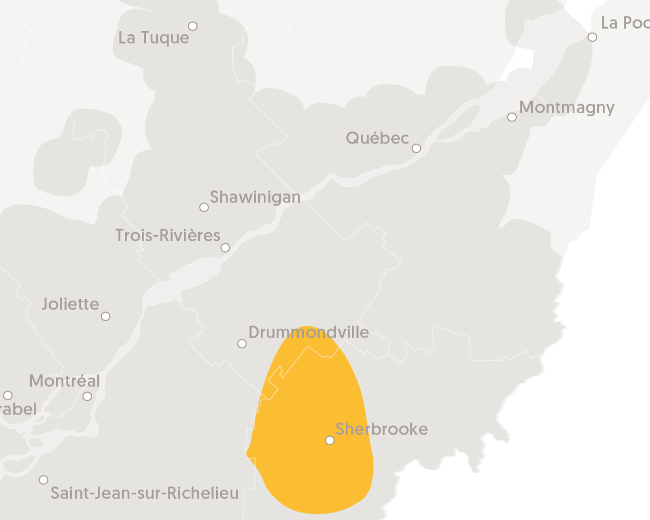
This region is made up of various plateaus ranging anywhere from 150 to 450 metres in altitude. The lowlands are situated between Durham and Melbourne, extending all the way to Victoriaville. The highlands are to the east of the Sutton Mountains, between Magog and Sherbrooke.
Géology and soils
The soils in the lowlands, derived from acidic to neutral sedimentary rocks, and are rocky and stony; whereas the soils in the highlands are less deep, acidic, rocky and stony.
Climate
The climate in the Appalachian Plateau is cooler than other regions located at lower altitudes (Appalachian Foothills, Richelieu River Valley, Lake Saint-Pierre). This region experiences more rainfall than the more southern areas of the province and generally has to cope with more snow cover than some of the other bordering regions.
LAKE SAINT-PIERRE
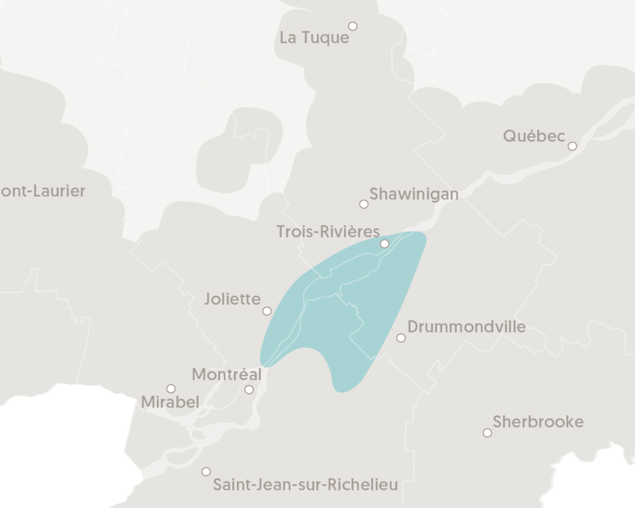
This vast region stretches along the southern (from Varennes to Bécancour) and northern (from Repentigny to Trois-Rivières) shores of the St. Lawrence River. It encompasses the drainage basins from the Lake Saint-Pierre tributaries, including the St. Lawrence River, as well as the Maskinongé, Yamachiche, Du-Loup, Aux-Sables, Richelieu, Yamaska, Saint-François and Nicolet rivers. The vineyards that wrap around Lake Saint-Pierre are planted on the site of the ancient Lampsilis Lake, a huge freshwater body dating back to 8,000 years B.C.
Geology and soils :
The soils in this region are mainly composed of marine sediments. Therefore, depending on the area, the soil may contain significant amounts of sand, clay or lime.
Climate :
The relative humidity around the banks of the St. Lawrence River and Lake Saint-Pierre is more pronounced, and temperature variances aren’t quite as extreme. This region is generally colder than the area south of the Monteregian Hills, except for the areas of Varennes and Saint-Amable, which are among the warmest in Quebec. The north shore of the St. Lawrence River and Lake Saint-Pierre generally has a lot more snow cover than the south shore.
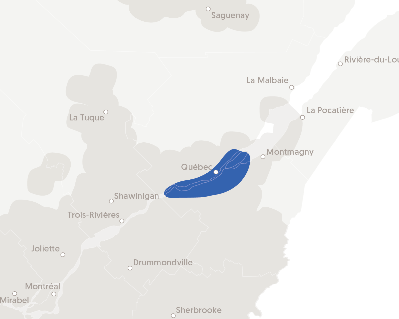
QUEBEC AND THE BANKS OF THE ST. LAWRENCE RIVER
This region extends into the southern outskirts of Quebec City, between Lotbinière and Bellechasse, and into the city’s northern suburbs, from Portneuf all the way to La Côte-de-Beaupré. It also includes Île d’Orléans, which follows the east-west flow of the St. Lawrence River.
Geologie and soils
This region has several limestone formations and shale outcrops, on which several vineyards have been planted. The majority of Île d’Orléans has loamy soils that contain significant amounts of clay, sand and gravel.
Climate
The region’s proximity to the river dictates its climate. In spring, the St. Lawrence River protects the vineyards from late frosts, while in the fall, it helps extend the growing season until the end of October. The southwestern part of Île d’Orléans has its very own microclimate, fostering the perfect environment for wine-growing. Battered by strong winds throughout the year, it is one of the coolest wine-growing regions in Quebec, and also experiences a lot more snowfall than most of the other regions.
EMERGING REGIONS
Some Quebec vineyards are located outside of these 9 regions. Indeed, the Quebec vineyard is still a young industry – emerging regions continue to develop.


